The inland shingle deposits of this area were mapped by Balchin for Steers (1937) At that time the western half of the Culbin area was already covered by forest and detailed mapping of that part proved inmossible. His maps shows a large shingle fan occupying the northeast portion of the foreland.
Aerial survey photographs of the Culbin area were taken in July 1967. This type of photograph is normally taken around midday to ensure the best light conditions, but one of this series roved to have been taken in the early morning and in spite of the tree cover, details of the land surface were outlined by the long shadows. It was thus possible to extend Balchin’s mapping of the shingle deposits southwestwards, and the pattern which emerged is shown in figure 1. It shows a long bar reaching southwest wards almost as far as the Cran Loch.
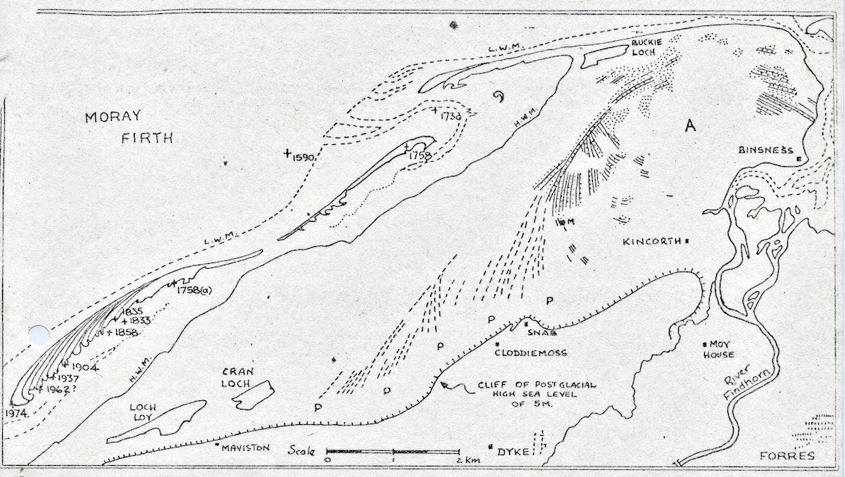
Today there is a small outcrop of rock visible north of the old cliff feature which marks the post glacial high sea level of 5 m. This is just north of Maviston. Pottery from a shell midden at the point M has been dated at 3500 BP there is only one n which emerged is shown in figure l. It shows a long bar BF. A large proportion of the shells in this site were winkles, a species which like a rocky coast, and this suggests that at that time rock surfaces were visible in the area.
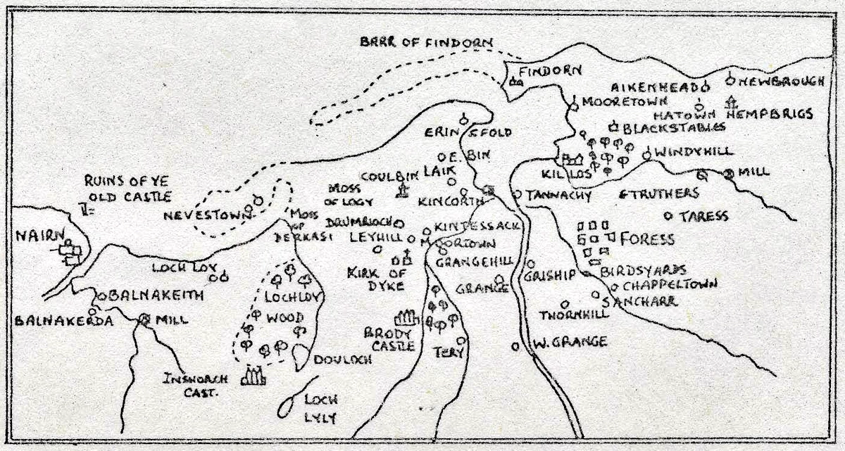
It is considered that the original course of the River Findhorn was to the south of the hooked shingle spit and as this extended the river was channelled southwestwards against the old cliff line. The channel silted up and the river burst through the bar somewhere near the present mouth of Findhorn Bay, whereupon a new bar began to grow westwards across this new opening. A manuscript map of western Moray by Rev Timothy Pent ea l59O (fig 2.) shows a long bar feature extending west to shelter a lagoon to the north of Loch Loy; while another is shown extending across the mouth of the River Findhorn, with the old village of Findhorn standing on the bar. Roger de Hoveden, chaplain to Henry ll, makes reference to a port at Loch Loy in 1196, and local tradition has it that there once was a fishing community at Maviston. At the foot of the “cliff” immediately north of Maviston, layers of sand and undisturbed shells can be found under a thin covering of soil. Peat underlies the blown sand.along the section marked P – P in fig” l, and this may well mark the line of the old river channel, which has slowly been covered by these later deposits.
The agricultural area of the old estate of Culbin lay in the part marked A in fig l. The old agricultural surfaces complete with rigs still can be found in places. Sections dug through the soil showed it to be a very thin layer under lain by sand. In a few places uncultivated deposits of estuarine silts and clays were found. A few eroded remnants of an old land surface at a slightly higher level can be seen capping the main storm beach shingle ridges and here there is a much more mature soil. The difference in levels between these two soil surfaces has yet to be measured but appears to be several metres. This gives the picture of a low curved promontory sheltering a shallow estuary which slowly silted up and which was later to become the agricultural area of Culbin, The poorness of the soil does, however, raise some doubt as to what extent the old Culbin estate was a flourishing granary. Outside the sweep of the shingle ridges the large expanse of sand extending westwards later to engulf the whole area.
On the map of the Old Bar fig l. the figures represent the positions of the western end of the bar taken from maps of these dates:
| 1974 | Position in March 1974 |
| 1962(?) | Ordance Survey probably revisions 1939-1950 |
| 1937 | Steers |
| 1904 | Ordnance Survey |
| 1858 | Legal map from a fishing dispute case |
| 1835 | Admiralty Survey |
| 1833 | Map of boundaries of Brodie Estates |
| 1758(a) | Peter May’s map using a mile of 2000 yards. This version is all on one scale |
| 1758 | Peter May’s map on which the western half of the map is on “half scale”. |
| 1730 | York Building Company Map, on which the scale of all features in Moray is distorted |
| 1590 | MS of Rev. Timothy Pont. The bar features are not included in the published version corrected by Gordon. |
References
1196 Chronica Rogeri de Hovenden (Rolls ed) IV pp 10.12
1937 Steers, A. The Culbin Sands and Burghead Bay. Geog J. 90,498-528