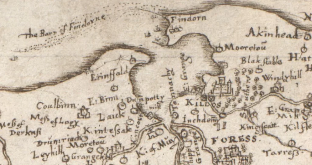
Extract from Rev. Timothy Pont's map 8 circa 1590
In his petition to the Scottish Parliament of 1695 Alexander Kinnaird stated that the best "two pairts" of his estate had been "quyte ruined and destroyed". It is a splendidly ambiguous statement. Two or three, or four, or seventeen?
The evidence collected to date indicates however that the part lost to sand in the closing years of the 17th Century was entirely, or largely confined to that Area A shown on Mr. Sinclair Ross‘ map in
Bulletin No. 2, inside the sweep of the shingle ridges.
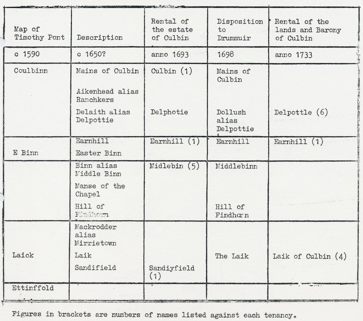
The principal source of information about the dimensions of the Culbin Estate is "Antiquarian Notes" by C. F. Mackintosh, Inverness, 1864, under the title "The Lost House of Culbin". It is a tantalising
document because Mr. Mackintosh was a considerable antiquarian but did not quote his sources, and did repeat the rental of 1693 which has so befogged subsequent writings about the estate. The Rev. James Murray in "The Kinnairds of Culbin" attempted to correct matters. "The sameness of rent paid by different tenants is such as can scarcely, if at all, be paralleled in another rent roll of the 17th Century. Out
of 16 farms in all, 13, so we read, paid £200 Scots ..... every one of them, in addition to 40 bolls each of wheat, bere, oats and oatmeal".
Mackintosh also quotes a "description of the lands from an old deed" which is much more credible. An analysis of the description is as follows:-
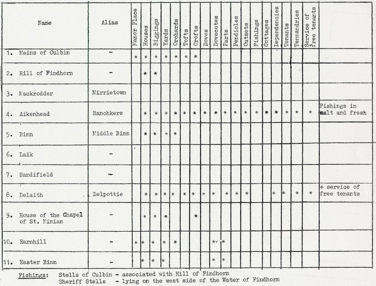
It can reasonably be assumed that this indicates the relative importance of the properties. Apart from the Manor House there were two major properties — Aikenhead and Delaith, two intermediate,
Earnhill and Easter Binn, three minor Hill of Findhorn, Binn, the Manse and three trivial, Mackrodder, Laik and Sandifield.
The only map which predates the inundation is that of Rev. Timothy Pont. The summary of Mackintosh's relevant data is as follows:-